Bought Right, Built Right
Due Diligence That Went the Distance
Sites read correctly up front, then designed, permitted, and delivered - follow any project for the full story.
Know what a parcel can carry - and what it will cost - before you own it. Feasibility reviews, ALTA surveys, and entitlement guidance for Wisconsin land deals.
Every land deal is priced on an assumption about what the site can become. Wetlands and floodplain, stormwater requirements, sanitary and water capacity, access, zoning, and land division rules all test that assumption - and the time to test it is during the contingency window, not after closing. A feasibility review puts the answers on the table while you can still negotiate the price, restructure the deal, or walk away.
The core of the review is work we perform in-house: zoning and setback analysis, land division feasibility, stormwater and floodplain screening, utility availability, access and driveway permitting, and concept grading with an opinion of probable site cost - plus the boundary, topographic, or ALTA/NSPS survey the transaction needs, performed by our own Wisconsin crews. Where the deal calls for a Phase I environmental site assessment or geotechnical borings, we coordinate trusted specialist partners and fold their findings into one picture.
Here is the advantage no checklist shows: we sit on the other side of the review table. Lynch & Associates serves as municipal engineer for communities across southeastern Wisconsin, reviewing development submittals for a living - experience that gives us an informed read on what reviewers look for and where a project like yours may draw questions. And when the deal closes, the same team carries the site straight into design, approvals, and construction.
Sites read correctly up front, then designed, permitted, and delivered - follow any project for the full story.
Scoped to the deal - a single-issue check or the full pre-purchase package.
We confirm the zoning district, permitted uses, setbacks, and density against your concept, and evaluate whether the parcel can be divided - not every parcel is divisible, and each community reviews divisions differently. You learn early whether the plan needs a variance, a rezone, or a different plan.
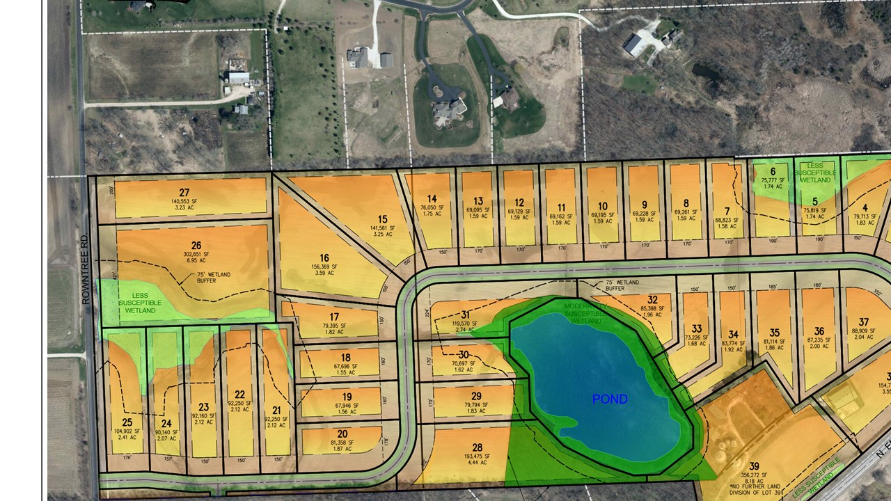
Detention, infiltration, and drainage easements all take land. We screen mapped floodplain and wetlands, read the drainage pattern, and estimate how much of the site stormwater will claim - so yield projections rest on buildable acres, not gross acres.
We confirm where sanitary sewer, water, and storm connections actually are, whether capacity exists for your use, and what extensions or district approvals stand between the parcel and service - often the largest hidden cost in a rural or edge-of-town deal.
Driveway spacing, sight distance, turn-lane triggers, and highway access permits can reshape a site plan. We evaluate access early - including WisDOT and county permit requirements - so the entrance you assume is the entrance you get.
Boundary, topographic, and ALTA/NSPS Land Title Surveys from our own Wisconsin crews, coordinated with the title commitment and lender requirements. The survey the closing needs doubles as the base map the design will need next.
Phase I environmental site assessments and soil borings are performed by trusted specialist partners we coordinate, with findings folded into the same feasibility picture as the civil and survey work - one review, one conclusion about the site.
Ideally before the offer, or inside the inspection contingency the offer negotiates. Zoning, stormwater rules, utility capacity, access, and floodplain all shape what a parcel can carry and what it is worth - and finding a constraint before closing costs a fraction of finding it after. We scope the review to the deal's timeline.
Phase I environmental site assessments and geotechnical borings are performed by trusted specialist partners we coordinate, with their findings folded into the same feasibility picture as the civil, survey, stormwater, and entitlement work we perform in-house - one review, one coordinator, one conclusion about the site.
Often, but not always - not every parcel is divisible. A Certified Survey Map is commonly used for smaller land divisions, lot line adjustments, and parcel reconfigurations; larger divisions may require a subdivision plat, depending on the number of parcels and applicable municipal and county requirements. We evaluate division feasibility as part of due diligence and can tell you early whether a proposed split is realistic.
It depends on the parcel and the question - a single-issue check costs less than a full pre-purchase package with survey work. Send the address and what you hope to build, and we will send a written scope and fee - no obligation.
More for developers: Land development engineering · National retail site development · How we work · Land surveying · Civil engineering in New Berlin